


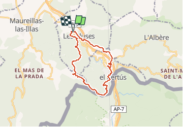
LES CLUSES 66 - LE PERTHUS -

jeff66
User

Length
14.4 km

Max alt
417 m

Uphill gradient
444 m
Km-Effort
20 km

Min alt
127 m

Downhill gradient
445 m
Boucle
Yes
Creation date :
2015-05-21 00:00:00.0
Updated on :
2015-05-21 00:00:00.0
2h57
Difficulty : Medium

FREE GPS app for hiking
 SityTrail
IGN / Geographical institutes
SityTrail Plus
The world is yours!
About
Trail Walking of 14.4 km to be discovered at Occitania, Pyrénées-Orientales, Les Cluses. This trail is proposed by jeff66.
Description
LES CLUSES - LE PERTHUS - fort de Bellegarde - col de Panissars - ruines romaines - Château des Maures
Positioning
Country:
France
Region :
Occitania
Department/Province :
Pyrénées-Orientales
Municipality :
Les Cluses
Location:
Unknown
Start:(Dec)
Start:(UTM)
486635 ; 4703753 (31T) N.
Comments